 vesseltracker.com
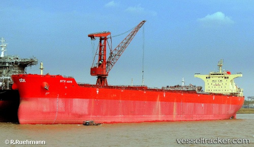
Pan Hope
Current StatusWhere is the vessel?
Pan Hope is currently in 102 nm SW of Panjang, based on AIS data received about 4h ago.
Latest AIS update:
Current position: 7.49010° S, 103.94643° E (102 nm SW of Panjang)
Average speed (last 7 days): Loading…
Average speed (last 30 days): Loading…
Vessel profile: Pan Hope is a Bulk Carrier with dimensions 45m x 292m.
This page combines live AIS, route history, probable destination signals, nearby traffic, and port activity for practical vessel monitoring.
The current position of vessel Pan Hope is -7.49010 lat / 103.94643 lng. Updated: 2026-04-17 21:24:02 UTCNearest reference points:
- 163 nm W of Panjang
- 29 nm SW of Tarahan
- 28 nm SW of Tarahan
Details:
Live Vessel Pan Hope Analytics (details, animations, etc.)
Recent AIS points (UTC):
2026-04-17 17:16:32 UTC · -7.96006, 103.41292 · SOG 10.2 kn · COG 48°2026-04-17 19:53:59 UTC · -7.66214, 103.74882 · SOG 10.2 kn · COG 46°
2026-04-17 21:24:02 UTC · -7.49010, 103.94643 · SOG 10.6 kn · COG 49°
2026-04-17 21:24:02 UTC · -7.49010, 103.94643 · SOG 10.6 kn · COG 49°