 vesseltracker.com
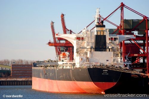
 Rutland
Current Status
Where is the vessel?
Rutland is currently in 104 nm N of Jolo, based on AIS data received about 1h ago.
Latest AIS update:
Current position: 7.71167° N, 120.46833° E (104 nm N of Jolo)
Average speed (last 7 days): Loading…
Average speed (last 30 days): Loading…
Vessel profile: Rutland is a Bulk Carrier with dimensions 292m x 45m.
This page combines live AIS, route history, probable destination signals, nearby traffic, and port activity for practical vessel monitoring.
The current position of vessel Rutland is 7.71167 lat / 120.46833 lng. Updated: 2026-03-31 11:19:09 UTCNearest reference points:
- 66 nm W of Jolo
- 21 nm NW of Zamboanga
- 14 nm SE of Zamboanga
Currently sailing under the flag of Liberia ![]()
Rutland built in 2009 year
Deadweight:
178031 tDetails:
Live Vessel Rutland Analytics (details, animations, etc.)
Recent AIS points (UTC):
2026-03-31 05:28:10 UTC · 6.70167, 120.10833 · SOG 10 kn · COG -1°2026-03-31 08:01:09 UTC · 7.16667, 120.27500 · SOG 10 kn · COG -1°
2026-03-31 09:55:10 UTC · 7.48167, 120.39167 · SOG 10 kn · COG -1°
2026-03-31 11:19:09 UTC · 7.71167, 120.46833 · SOG 10 kn · COG -1°