 vesseltracker.com
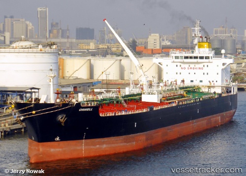
 ORWELL
Current Status
Where is the vessel?
ORWELL is currently in Near Paranagua, based on AIS data received less than 1h ago.
Latest AIS update:
Current position: 25.50071° S, 48.53351° W (Near Paranagua)
Average speed (last 7 days): Loading…
Average speed (last 30 days): Loading…
Vessel profile: ORWELL is a Oil/Chemical Tanker with dimensions m x m.
This page combines live AIS, route history, probable destination signals, nearby traffic, and port activity for practical vessel monitoring.
The current position of vessel ORWELL is -25.50071 lat / -48.53351 lng. Updated: 2026-04-19 22:22:58 UTCNearest reference points:
- 24 nm E of Caioba
- 32 nm E of Caioba
- Near Itajai
Currently sailing under the flag of Liberia ![]()
Details:
Live Vessel ORWELL Analytics (details, animations, etc.)
Recent AIS points (UTC):
2026-04-19 19:17:47 UTC · -25.69340, -48.17747 · SOG 7.1 kn · COG 312°2026-04-19 19:37:17 UTC · -25.66601, -48.21044 · SOG 6.7 kn · COG 310°
2026-04-19 22:02:47 UTC · -25.50070, -48.53347 · SOG 0 kn · COG 253°
2026-04-19 22:22:58 UTC · -25.50071, -48.53351 · SOG 0 kn · COG 254°