 vesseltracker.com
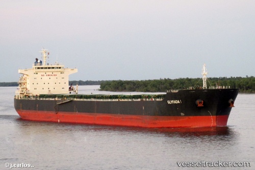
 Glyfada I
Current Status
Where is the vessel?
Glyfada I is currently in 293 nm W of Caufield North, based on AIS data received about 1h ago.
Latest AIS update:
Current position: 36.18667° S, 9.12000° E (293 nm W of Caufield North)
Average speed (last 7 days): Loading…
Average speed (last 30 days): Loading…
Vessel profile: Glyfada I is a Bulk Carrier with dimensions 225m x 32m.
This page combines live AIS, route history, probable destination signals, nearby traffic, and port activity for practical vessel monitoring.
The current position of vessel Glyfada I is -36.18667 lat / 9.12000 lng. Updated: 2026-04-17 08:21:23 UTCNearest reference points:
- Open sea, approx. 402 nm off the nearest listed port
- Open sea, approx. 404 nm off the nearest listed port
- Open sea, approx. 406 nm off the nearest listed port
Currently sailing under the flag of Malta ![]()
Glyfada I built in 2009 year
Deadweight:
75639 tDetails:
Live Vessel Glyfada I Analytics (details, animations, etc.)
Recent AIS points (UTC):
2026-04-17 02:32:06 UTC · -36.30336, 8.14764 · SOG 8.4 kn · COG 90°2026-04-17 03:42:20 UTC · -36.27833, 8.34833 · SOG 8 kn · COG -1°
2026-04-17 05:35:36 UTC · -36.25982, 8.65177 · SOG 7.7 kn · COG 98°
2026-04-17 08:21:23 UTC · -36.18667, 9.12000 · SOG 8 kn · COG -1°