 vesseltracker.com
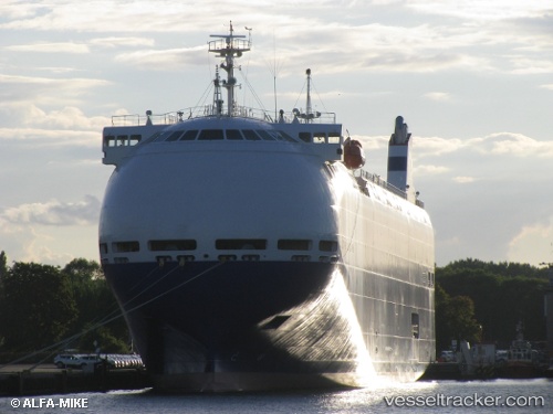
 City Of Rotterdam
Current Status
Where is the vessel?
City Of Rotterdam is currently in 27 nm SE of Holbury, based on AIS data received about 1h ago.
Latest AIS update:
Current position: 50.16495° N, 0.86561° W (27 nm SE of Holbury)
Average speed (last 7 days): Loading…
Average speed (last 30 days): Loading…
Vessel profile: City Of Rotterdam is a Vehicles Carrier with dimensions 140m x 22m.
This page combines live AIS, route history, probable destination signals, nearby traffic, and port activity for practical vessel monitoring.
The current position of vessel City Of Rotterdam is 50.16495 lat / -0.86561 lng. Updated: 2026-03-28 01:46:03 UTCNearest reference points:
- 15 nm S of Selsey
- Near Holbury
- 24 nm N of Fermanville
Currently sailing under the flag of Panama ![]()
City Of Rotterdam built in 2011 year
Deadweight:
5000 tDetails:
Live Vessel City Of Rotterdam Analytics (details, animations, etc.)
Recent AIS points (UTC):
2026-03-27 20:04:46 UTC · 49.78180, -3.00853 · SOG 14.5 kn · COG 72°2026-03-27 22:00:58 UTC · 49.91303, -2.32279 · SOG 14.3 kn · COG 73°
2026-03-27 23:51:35 UTC · 50.02822, -1.63784 · SOG 15.4 kn · COG 70°
2026-03-28 01:46:03 UTC · 50.16495, -0.86561 · SOG 16.6 kn · COG 69°