 vesseltracker.com
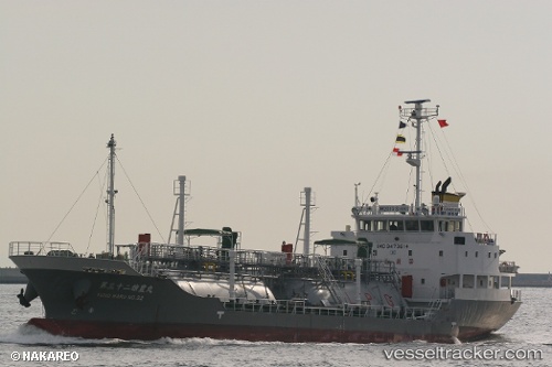
Yuhomaru No.32
Current StatusWhere is the vessel?
Yuhomaru No.32 is currently in Near MARUGAME, based on AIS data received less than 1h ago.
Latest AIS update:
Current position: 34.32167° N, 133.76840° E (Near MARUGAME)
Average speed (last 7 days): Loading…
Average speed (last 30 days): Loading…
Vessel profile: Yuhomaru No.32 is a Lpg Tanker with dimensions 11m x 67m.
This page combines live AIS, route history, probable destination signals, nearby traffic, and port activity for practical vessel monitoring.
The current position of vessel Yuhomaru No.32 is 34.32167 lat / 133.76840 lng. Updated: 2026-04-07 20:20:03 UTCNearest reference points:
- Near Sakaide
- Near Ayagawa
- Near MIZUSHIMA
Details:
Live Vessel Yuhomaru No.32 Analytics (details, animations, etc.)
Recent AIS points (UTC):
2026-04-07 13:51:03 UTC · 34.31487, 133.71864 · SOG 11.8 kn · COG 73°2026-04-07 15:29:06 UTC · 34.32079, 133.76768 · SOG 0 kn · COG 344°
2026-04-07 18:14:07 UTC · 34.32161, 133.76833 · SOG 0 kn · COG 243°
2026-04-07 20:20:03 UTC · 34.32167, 133.76840 · SOG 0 kn · COG 230°