 vesseltracker.com
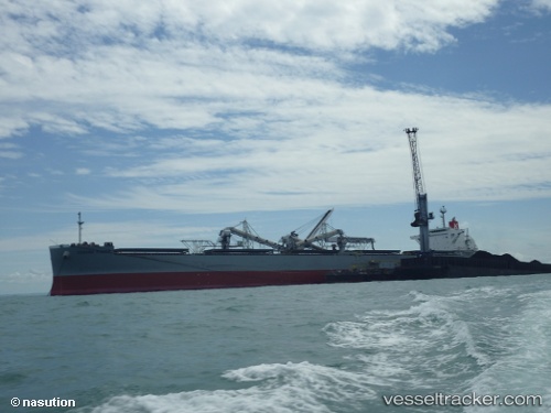
Corona Power
Current StatusWhere is the vessel?
Corona Power is currently in 30 nm SE of Okao, based on AIS data received about 1h ago.
Latest AIS update:
Current position: 4.35833° S, 116.44333° E (30 nm SE of Okao)
Average speed (last 7 days): Loading…
Average speed (last 30 days): Loading…
Vessel profile: Corona Power is a Bulk Carrier with dimensions 37m x 228m.
This page combines live AIS, route history, probable destination signals, nearby traffic, and port activity for practical vessel monitoring.
The current position of vessel Corona Power is -4.35833 lat / 116.44333 lng. Updated: 2026-04-07 07:16:07 UTCNearest reference points:
- 12 nm SE of Bunati
- 70 nm S of MEKAR PUTIH
- Near Bunati
Details:
Live Vessel Corona Power Analytics (details, animations, etc.)
Recent AIS points (UTC):
2026-04-07 02:25:06 UTC · -4.51833, 115.53667 · SOG 11 kn · COG -1°2026-04-07 04:01:08 UTC · -4.49167, 115.84833 · SOG 11 kn · COG -1°
2026-04-07 05:43:06 UTC · -4.47833, 116.17500 · SOG 11 kn · COG -1°
2026-04-07 07:16:07 UTC · -4.35833, 116.44333 · SOG 11 kn · COG -1°