 vesseltracker.com
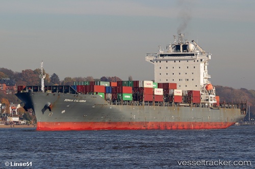
 Songa Calabria
Current Status
Where is the vessel?
Songa Calabria is currently in Near Tobishima-Mura, based on AIS data received about 1h ago.
Latest AIS update:
Current position: 35.02646° N, 136.82088° E (Near Tobishima-Mura)
Average speed (last 7 days): Loading…
Average speed (last 30 days): Loading…
Vessel profile: Songa Calabria is a Container Ship with dimensions 261m x 261m.
This page combines live AIS, route history, probable destination signals, nearby traffic, and port activity for practical vessel monitoring.
The current position of vessel Songa Calabria is 35.02646 lat / 136.82088 lng. Updated: 2026-04-01 01:27:44 UTCNearest reference points:
- Near Nagoya
- Near Yokkaichi
- Near Kinuura
Currently sailing under the flag of Liberia ![]()
Songa Calabria built in 2010 year
Deadweight:
50353 tDetails:
Live Vessel Songa Calabria Analytics (details, animations, etc.)
Recent AIS points (UTC):
2026-03-31 20:07:01 UTC · 35.02646, 136.82092 · SOG 0 kn · COG 257°2026-03-31 21:48:43 UTC · 35.02644, 136.82092 · SOG 0 kn · COG 257°
2026-04-01 00:15:45 UTC · 35.02650, 136.82104 · SOG 0 kn · COG 257°
2026-04-01 01:27:44 UTC · 35.02646, 136.82088 · SOG 0 kn · COG 257°