 vesseltracker.com
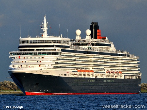
 Queen Elizabeth
Current Status
Where is the vessel?
Queen Elizabeth is currently in 24 nm NE of Bufadero, based on AIS data received less than 1h ago.
Latest AIS update:
Current position: 21.91401° N, 77.02791° W (24 nm NE of Bufadero)
Average speed (last 7 days): Loading…
Average speed (last 30 days): Loading…
Vessel profile: Queen Elizabeth is a Cruise Ship with dimensions 294m x 36m.
This page combines live AIS, route history, probable destination signals, nearby traffic, and port activity for practical vessel monitoring.
The current position of vessel Queen Elizabeth is 21.91401 lat / -77.02791 lng. Updated: 2026-04-13 15:55:51 UTCNearest reference points:
- 36 nm E of Cayo Coco
- 16 nm SE of Ceiba Hueca
- Near Great Exuma Island
Currently sailing under the flag of Bermuda ![]()
Queen Elizabeth built in 2010 year
Deadweight:
7685 tDetails:
Live Vessel Queen Elizabeth Analytics (details, animations, etc.)
Recent AIS points (UTC):
2026-04-13 10:06:22 UTC · 21.26667, -75.30667 · SOG 18 kn · COG -1°2026-04-13 11:39:02 UTC · 21.42380, -75.76051 · SOG 17.7 kn · COG 295°
2026-04-13 14:09:57 UTC · 21.70500, -76.51667 · SOG 18 kn · COG -1°
2026-04-13 15:55:51 UTC · 21.91401, -77.02791 · SOG 18 kn · COG -1°