 vesseltracker.com
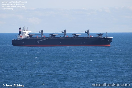
Astrantia
Current StatusWhere is the vessel?
Astrantia is currently in Near ISHINOMAKI, based on AIS data received about 1h ago.
Latest AIS update:
Current position: 38.35030° N, 141.32278° E (Near ISHINOMAKI)
Average speed (last 7 days): Loading…
Average speed (last 30 days): Loading…
Vessel profile: Astrantia is a Wood Chips Carrier with dimensions 36m x 210m.
This page combines live AIS, route history, probable destination signals, nearby traffic, and port activity for practical vessel monitoring.
The current position of vessel Astrantia is 38.35030 lat / 141.32278 lng. Updated: 2026-03-27 13:26:42 UTCNearest reference points:
- Near ISHINOMAKI
- Near Shiogama
- Near ONAGAWA
Details:
Live Vessel Astrantia Analytics (details, animations, etc.)
Recent AIS points (UTC):
2026-03-27 08:05:42 UTC · 38.35036, 141.32275 · SOG 0.1 kn · COG 125°2026-03-27 09:56:42 UTC · 38.35042, 141.32291 · SOG 0.1 kn · COG 131°
2026-03-27 11:29:42 UTC · 38.35043, 141.32310 · SOG 0 kn · COG 135°
2026-03-27 13:26:42 UTC · 38.35030, 141.32278 · SOG 0.1 kn · COG 130°