 vesseltracker.com
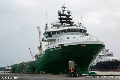
 Havila Clipper
Current Status
Where is the vessel?
Havila Clipper is currently in Near Mongstadbase, based on AIS data received about 1h ago.
Latest AIS update:
Current position: 60.79147° N, 5.07259° E (Near Mongstadbase)
Average speed (last 7 days): Loading…
Average speed (last 30 days): Loading…
Vessel profile: Havila Clipper is a Offshore Tug Supply Ship with dimensions 80m x 18m.
This page combines live AIS, route history, probable destination signals, nearby traffic, and port activity for practical vessel monitoring.
The current position of vessel Havila Clipper is 60.79147 lat / 5.07259 lng. Updated: 2026-04-03 20:28:18 UTCNearest reference points:
- Near Eivindvik
- Near Solund
- Near Skålevik
Currently sailing under the flag of Norway ![]()
Havila Clipper built in 2011 year
Deadweight:
3683 tDetails:
Live Vessel Havila Clipper Analytics (details, animations, etc.)
Recent AIS points (UTC):
2026-04-03 14:13:16 UTC · 60.79148, 5.07262 · SOG 0 kn · COG 140°2026-04-03 16:25:16 UTC · 60.79147, 5.07259 · SOG 0 kn · COG 137°
2026-04-03 17:19:19 UTC · 60.79147, 5.07257 · SOG 0 kn · COG 140°
2026-04-03 20:28:18 UTC · 60.79147, 5.07259 · SOG 0 kn · COG 140°