 vesseltracker.com
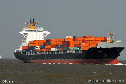
 Porto
Porto
Current Status
Where is the vessel?
Porto is currently in Open sea, approx. 407 nm off the nearest listed port, based on AIS data received less than 1h ago.
Latest AIS update:
Current position: 38.16500° N, 151.68832° E (Open sea, approx. 407 nm off the nearest listed port)
Average speed (last 7 days): Loading…
Average speed (last 30 days): Loading…
Vessel profile: Porto is a Container Ship with dimensions 225m x 30m.
This page combines live AIS, route history, probable destination signals, nearby traffic, and port activity for practical vessel monitoring.
The current position of vessel Porto is 38.16500 lat / 151.68832 lng. Updated: 2026-04-19 15:46:06 UTCNearest reference points:
- Open sea, approx. 407 nm off the nearest listed port
- Open sea, approx. 411 nm off the nearest listed port
- Open sea, approx. 406 nm off the nearest listed port
Currently sailing under the flag of Liberia ![]()
Porto built in 2010 year
Deadweight:
39267 tDetails:
Live Vessel Porto Analytics (details, animations, etc.)
Recent AIS points (UTC):
2026-04-19 12:19:08 UTC · 37.91833, 150.30833 · SOG 20 kn · COG -1°2026-04-19 13:49:32 UTC · 38.02998, 150.93130 · SOG 19.4 kn · COG 72°
2026-04-19 13:52:07 UTC · 38.03167, 150.94833 · SOG 19 kn · COG -1°
2026-04-19 15:46:06 UTC · 38.16500, 151.68832 · SOG 18 kn · COG -1°