 vesseltracker.com
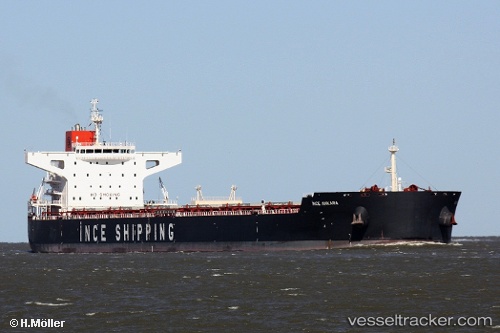
Ince Ankara
Current StatusWhere is the vessel?
Ince Ankara is currently in 20 nm SW of Karatas, based on AIS data received about 2h ago.
Latest AIS update:
Current position: 36.27305° N, 35.15177° E (20 nm SW of Karatas)
Average speed (last 7 days): Loading…
Average speed (last 30 days): Loading…
Vessel profile: Ince Ankara is a Bulk Carrier with dimensions 43m x 253m.
This page combines live AIS, route history, probable destination signals, nearby traffic, and port activity for practical vessel monitoring.
The current position of vessel Ince Ankara is 36.27305 lat / 35.15177 lng. Updated: 2026-04-16 19:51:29 UTCNearest reference points:
- Near Mersin
- Near Mersin-Free Zone
- 13 nm W of Iskenderun
Details:
Live Vessel Ince Ankara Analytics (details, animations, etc.)
Recent AIS points (UTC):
2026-04-16 11:22:10 UTC · 36.69894, 36.18460 · SOG 0 kn · COG 66°2026-04-16 13:40:14 UTC · 36.69896, 36.18460 · SOG 0 kn · COG 66°
2026-04-16 15:25:49 UTC · 36.68645, 36.15626 · SOG 7.8 kn · COG 261°
2026-04-16 19:51:29 UTC · 36.27305, 35.15177 · SOG 13 kn · COG 250°