 vesseltracker.com
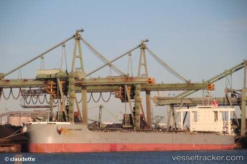
 Cape Canary
Current Status
Where is the vessel?
Cape Canary is currently in Near HIGASHIHARIMA, based on AIS data received less than 1h ago.
Latest AIS update:
Current position: 34.70667° N, 134.83667° E (Near HIGASHIHARIMA)
Average speed (last 7 days): Loading…
Average speed (last 30 days): Loading…
Vessel profile: Cape Canary is a Bulk Carrier with dimensions 292m x 46m.
This page combines live AIS, route history, probable destination signals, nearby traffic, and port activity for practical vessel monitoring.
The current position of vessel Cape Canary is 34.70667 lat / 134.83667 lng. Updated: 2026-04-19 07:54:59 UTCNearest reference points:
- Near HIGASHIHARIMA
- Near KAKOGAWA
- Near AKASHI
Currently sailing under the flag of Japan ![]()
Cape Canary built in 2009 year
Deadweight:
182577 tDetails:
Live Vessel Cape Canary Analytics (details, animations, etc.)
Recent AIS points (UTC):
2026-04-19 02:03:57 UTC · 34.70667, 134.83667 · SOG 0 kn · COG -1°2026-04-19 03:45:58 UTC · 34.70667, 134.83667 · SOG 0 kn · COG -1°
2026-04-19 05:57:58 UTC · 34.70667, 134.83667 · SOG 0 kn · COG -1°
2026-04-19 07:54:59 UTC · 34.70667, 134.83667 · SOG 0 kn · COG -1°