 vesseltracker.com
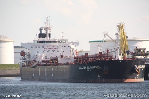
 UOG HARRIET G
Current Status
Where is the vessel?
UOG HARRIET G is currently in 93 nm SW of Bonga, based on AIS data received about 1h ago.
Latest AIS update:
Current position: 3.27131° N, 3.79065° E (93 nm SW of Bonga)
Average speed (last 7 days): Loading…
Average speed (last 30 days): Loading…
Vessel profile: UOG HARRIET G is a Crude Oil Tanker with dimensions 228m x 32m.
This page combines live AIS, route history, probable destination signals, nearby traffic, and port activity for practical vessel monitoring.
The current position of vessel UOG HARRIET G is 3.27131 lat / 3.79065 lng. Updated: 2026-04-08 00:00:55 UTCNearest reference points:
- Near Escravos
- Near WARRI
Currently sailing under the flag of Marshall Islands ![]()
UOG HARRIET G built in 2009 year
Deadweight:
73338 tDetails:
Live Vessel UOG HARRIET G Analytics (details, animations, etc.)
Recent AIS points (UTC):
2026-04-07 17:25:30 UTC · 3.18167, 4.91833 · SOG 10 kn · COG -1°2026-04-07 19:57:47 UTC · 3.20947, 4.48254 · SOG 10.2 kn · COG 275°
2026-04-07 21:46:32 UTC · 3.24500, 4.17667 · SOG 10 kn · COG -1°
2026-04-08 00:00:55 UTC · 3.27131, 3.79065 · SOG 10.3 kn · COG 273°