 vesseltracker.com
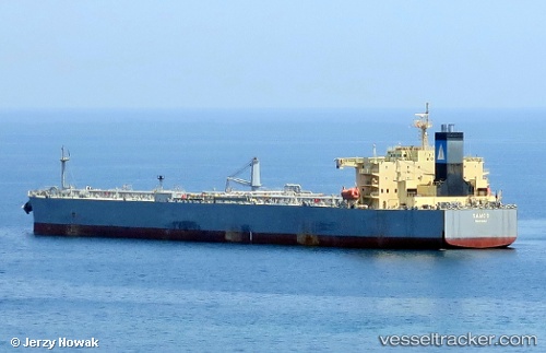
Samos
Current StatusWhere is the vessel?
Samos is currently in Near Colón Free Zone, based on AIS data received less than 1h ago.
Latest AIS update:
Current position: 9.33206° N, 79.91951° W (Near Colón Free Zone)
Average speed (last 7 days): Loading…
Average speed (last 30 days): Loading…
Vessel profile: Samos is a Crude Oil Tanker with dimensions 42m x 228m.
This page combines live AIS, route history, probable destination signals, nearby traffic, and port activity for practical vessel monitoring.
The current position of vessel Samos is 9.33206 lat / -79.91951 lng. Updated: 2026-04-19 09:40:09 UTCNearest reference points:
- Near Colón Free Zone
- Near Colon
- Near COLON 2000
Details:
Live Vessel Samos Analytics (details, animations, etc.)
Recent AIS points (UTC):
2026-04-19 03:21:25 UTC · 9.49276, -79.95474 · SOG 0 kn · COG 225°2026-04-19 05:53:28 UTC · 9.49304, -79.95505 · SOG 0 kn · COG 213°
2026-04-19 07:56:21 UTC · 9.47937, -79.91981 · SOG 5.5 kn · COG 175°
2026-04-19 09:40:09 UTC · 9.33206, -79.91951 · SOG 8.3 kn · COG 181°