 vesseltracker.com
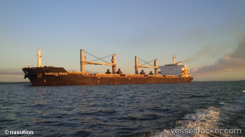
Magnum Power
Current StatusWhere is the vessel?
Magnum Power is currently in 393 nm N of Fanning Island, based on AIS data received about 57d ago.
Latest AIS update:
Current position: 10.37586° N, 159.94110° W (393 nm N of Fanning Island)
Average speed (last 7 days): Loading…
Average speed (last 30 days): Loading…
Vessel profile: Magnum Power is a Bulk Carrier with dimensions 32m x 189m.
This page combines live AIS, route history, probable destination signals, nearby traffic, and port activity for practical vessel monitoring.
The current position of vessel Magnum Power is 10.37586 lat / -159.94110 lng. Updated: 2026-02-20 18:31:50 UTCNearest reference points:
- Open sea (no nearby ports in database)
- Open sea, approx. 412 nm off the nearest listed port
- Open sea, approx. 419 nm off the nearest listed port
Details:
Live Vessel Magnum Power Analytics (details, animations, etc.)
Recent AIS points (UTC):
2026-02-20 18:31:50 UTC · 10.37586, -159.94110 · SOG 60.7 kn · COG 50°