 vesseltracker.com
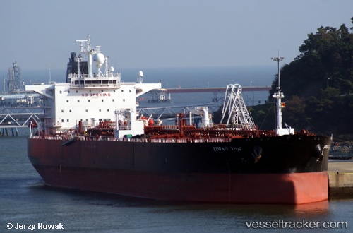
 Liwa v
Current Status
Where is the vessel?
Liwa v is currently in 24 nm W of Air Parcel Sorting Office/Mumbai, based on AIS data received about 1h ago.
Latest AIS update:
Current position: 18.92882° N, 72.37803° E (24 nm W of Air Parcel Sorting Office/Mumbai)
Average speed (last 7 days): Loading…
Average speed (last 30 days): Loading…
Vessel profile: Liwa v is a Crude Oil Tanker with dimensions 244m x 42m.
This page combines live AIS, route history, probable destination signals, nearby traffic, and port activity for practical vessel monitoring.
The current position of vessel Liwa v is 18.92882 lat / 72.37803 lng. Updated: 2026-04-21 04:09:44 UTCNearest reference points:
- Near Mumbai
- Near HNB SEZ/Mumbai
- Near NHAVA SHEVA
Currently sailing under the flag of Liberia ![]()
Liwa v built in 2011 year
Deadweight:
105221 tDetails:
Live Vessel Liwa v Analytics (details, animations, etc.)
Recent AIS points (UTC):
2026-04-21 02:03:43 UTC · 18.92784, 72.37560 · SOG 0.2 kn · COG 13°2026-04-21 02:39:09 UTC · 18.92849, 72.37493 · SOG 0.1 kn · COG -1°
2026-04-21 03:39:22 UTC · 18.92796, 72.37681 · SOG 0.2 kn · COG -1°
2026-04-21 04:09:44 UTC · 18.92882, 72.37803 · SOG 0.1 kn · COG 308°