 vesseltracker.com
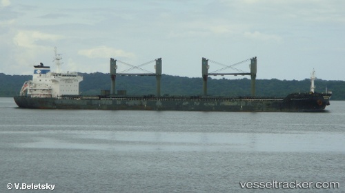
 NORDIC LONDON
Current Status
Where is the vessel?
NORDIC LONDON is currently in Near Tocopilla, based on AIS data received less than 1h ago.
Latest AIS update:
Current position: 22.07338° S, 70.20772° W (Near Tocopilla)
Average speed (last 7 days): Loading…
Average speed (last 30 days): Loading…
Vessel profile: NORDIC LONDON is a Bulk Carrier with dimensions 185m x 30m.
This page combines live AIS, route history, probable destination signals, nearby traffic, and port activity for practical vessel monitoring.
The current position of vessel NORDIC LONDON is -22.07338 lat / -70.20772 lng. Updated: 2026-04-17 19:36:07 UTCNearest reference points:
- 17 nm W of Puerto Angamos
Currently sailing under the flag of Marshall Islands ![]()
NORDIC LONDON built in 2010 year
Deadweight:
34904 tDetails:
Live Vessel NORDIC LONDON Analytics (details, animations, etc.)
Recent AIS points (UTC):
2026-04-17 12:30:09 UTC · -22.07301, -70.20852 · SOG 0.1 kn · COG 182°2026-04-17 14:06:07 UTC · -22.07338, -70.20759 · SOG 0.1 kn · COG 218°
2026-04-17 16:54:11 UTC · -22.07315, -70.20793 · SOG 0.2 kn · COG 201°
2026-04-17 19:36:07 UTC · -22.07338, -70.20772 · SOG 0.1 kn · COG 214°