 vesseltracker.com
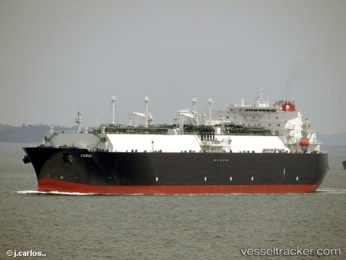
 Cubal
Cubal
Current Status
Where is the vessel?
Cubal is currently in Open sea, approx. 506 nm off the nearest listed port, based on AIS data received about 1h ago.
Latest AIS update:
Current position: 6.42333° N, 59.91167° E (Open sea, approx. 506 nm off the nearest listed port)
Average speed (last 7 days): Loading…
Average speed (last 30 days): Loading…
Vessel profile: Cubal is a Lng Tanker with dimensions 285m x 44m.
This page combines live AIS, route history, probable destination signals, nearby traffic, and port activity for practical vessel monitoring.
The current position of vessel Cubal is 6.42333 lat / 59.91167 lng. Updated: 2026-04-17 06:10:54 UTCNearest reference points:
- Open sea, approx. 506 nm off the nearest listed port
- Open sea, approx. 504 nm off the nearest listed port
- Open sea, approx. 500 nm off the nearest listed port
Currently sailing under the flag of Bahamas ![]()
Cubal built in 2012 year
Deadweight:
82834 tDetails:
Live Vessel Cubal Analytics (details, animations, etc.)
Recent AIS points (UTC):
2026-04-16 23:58:55 UTC · 7.65500, 60.88167 · SOG 15 kn · COG -1°2026-04-17 01:27:57 UTC · 7.35831, 60.64773 · SOG 14.6 kn · COG 215°
2026-04-17 04:22:56 UTC · 6.78333, 60.19667 · SOG 15 kn · COG -1°
2026-04-17 06:10:54 UTC · 6.42333, 59.91167 · SOG 15 kn · COG -1°