 vesseltracker.com
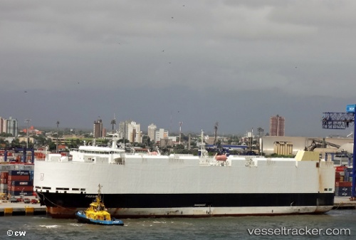
 VIKING PASSAMA
Current Status
Where is the vessel?
VIKING PASSAMA is currently in 18 nm SW of Willow Grove, based on AIS data received less than 1h ago.
Latest AIS update:
Current position: 39.10027° S, 146.00464° E (18 nm SW of Willow Grove)
Average speed (last 7 days): Loading…
Average speed (last 30 days): Loading…
Vessel profile: VIKING PASSAMA is a Vehicles Carrier with dimensions 30m x 182m.
This page combines live AIS, route history, probable destination signals, nearby traffic, and port activity for practical vessel monitoring.
The current position of vessel VIKING PASSAMA is -39.10027 lat / 146.00464 lng. Updated: 2026-04-01 07:41:42 UTCNearest reference points:
- Near Hastings
- Near QUEENSCLIFF
- Near Spotswood
Currently sailing under the flag of Marshall Islands ![]()
VIKING PASSAMA built in 2012 year
Deadweight:
12806 tDetails:
Live Vessel VIKING PASSAMA Analytics (details, animations, etc.)
Recent AIS points (UTC):
2026-04-01 02:15:29 UTC · -38.82317, 147.78142 · SOG 15.3 kn · COG 257°2026-04-01 03:49:30 UTC · -38.94086, 147.30469 · SOG 14.9 kn · COG 254°
2026-04-01 05:41:16 UTC · -39.09366, 146.72128 · SOG 17.2 kn · COG 251°
2026-04-01 07:41:42 UTC · -39.10027, 146.00464 · SOG 18 kn · COG 298°