 vesseltracker.com
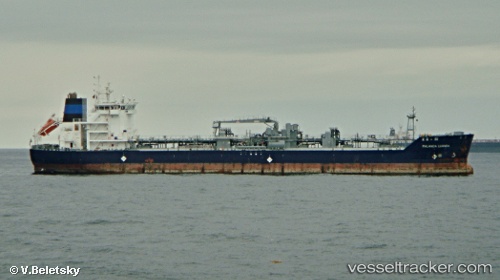
 The Amigo
Current Status
Where is the vessel?
The Amigo is currently in 54 nm SE of South Bristol, based on AIS data received about 1h ago.
Latest AIS update:
Current position: 43.06492° N, 68.94506° W (54 nm SE of South Bristol)
Average speed (last 7 days): Loading…
Average speed (last 30 days): Loading…
Vessel profile: The Amigo is a Bitumen Tanker with dimensions 134m x 23m.
This page combines live AIS, route history, probable destination signals, nearby traffic, and port activity for practical vessel monitoring.
The current position of vessel The Amigo is 43.06492 lat / -68.94506 lng. Updated: 2026-03-28 12:15:21 UTCNearest reference points:
- 30 nm E of York Beach
- Near ROCKPORT
- Near Harpswell Center
Currently sailing under the flag of Marshall Is ![]()
The Amigo built in 2012 year
Deadweight:
14911 tDetails:
Live Vessel The Amigo Analytics (details, animations, etc.)
Recent AIS points (UTC):
2026-03-28 05:30:17 UTC · 42.37162, -70.26211 · SOG 9.9 kn · COG 53°2026-03-28 08:15:07 UTC · 42.65300, -69.74019 · SOG 10.9 kn · COG 56°
2026-03-28 10:09:08 UTC · 42.84582, -69.35513 · SOG 10.8 kn · COG 51°
2026-03-28 12:15:21 UTC · 43.06492, -68.94506 · SOG 10.6 kn · COG 55°