 vesseltracker.com
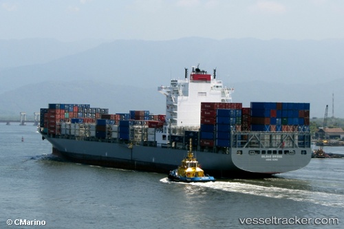
 KOBE C
Current Status
Where is the vessel?
KOBE C is currently in 84 nm SE of Fort Dauphin, based on AIS data received about 2h ago.
Latest AIS update:
Current position: 26.08616° S, 48.00398° E (84 nm SE of Fort Dauphin)
Average speed (last 7 days): Loading…
Average speed (last 30 days): Loading…
Vessel profile: KOBE C is a Container Ship with dimensions m x m.
This page combines live AIS, route history, probable destination signals, nearby traffic, and port activity for practical vessel monitoring.
The current position of vessel KOBE C is -26.08616 lat / 48.00398 lng. Updated: 2026-04-18 05:34:18 UTCNearest reference points:
- 174 nm S of Ambovombe
- 106 nm S of Tsiombe
Currently sailing under the flag of Liberia ![]()
Details:
Live Vessel KOBE C Analytics (details, animations, etc.)
Recent AIS points (UTC):
2026-04-18 00:24:43 UTC · -26.74457, 46.62303 · SOG 14.7 kn · COG 61°2026-04-18 01:40:15 UTC · -26.60505, 46.92206 · SOG 14.7 kn · COG 62°
2026-04-18 03:56:14 UTC · -26.31760, 47.51831 · SOG 20.1 kn · COG 62°
2026-04-18 05:34:18 UTC · -26.08616, 48.00398 · SOG 16.9 kn · COG 63°