 vesseltracker.com
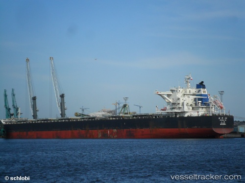
 SHI DAI 20
Current Status
Where is the vessel?
SHI DAI 20 is currently in Near Da Chan Bay, based on AIS data received about 1h ago.
Latest AIS update:
Current position: 22.50352° N, 113.75235° E (Near Da Chan Bay)
Average speed (last 7 days): Loading…
Average speed (last 30 days): Loading…
Vessel profile: SHI DAI 20 is a Bulk Carrier with dimensions m x m.
This page combines live AIS, route history, probable destination signals, nearby traffic, and port activity for practical vessel monitoring.
The current position of vessel SHI DAI 20 is 22.50352 lat / 113.75235 lng. Updated: 2026-03-29 05:46:08 UTCNearest reference points:
- Near Da Chan Bay
- Near SHENZHEN
- Near CHIWAN
Currently sailing under the flag of China ![]()
Details:
Live Vessel SHI DAI 20 Analytics (details, animations, etc.)
Recent AIS points (UTC):
2026-03-28 23:46:09 UTC · 22.50510, 113.75365 · SOG 0 kn · COG 158°2026-03-29 00:34:08 UTC · 22.50503, 113.75352 · SOG 0 kn · COG 153°
2026-03-29 03:34:08 UTC · 22.50422, 113.75255 · SOG 0.1 kn · COG 117°
2026-03-29 05:46:08 UTC · 22.50352, 113.75235 · SOG 0 kn · COG 91°