 vesseltracker.com
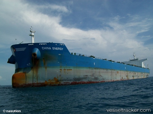
China Energy
Current StatusWhere is the vessel?
China Energy is currently in 128 nm NW of Ankokoambo, based on AIS data received less than 1h ago.
Latest AIS update:
Current position: 14.85953° S, 43.14100° E (128 nm NW of Ankokoambo)
Average speed (last 7 days): Loading…
Average speed (last 30 days): Loading…
Vessel profile: China Energy is a Bulk Carrier with dimensions 43m x 255m.
This page combines live AIS, route history, probable destination signals, nearby traffic, and port activity for practical vessel monitoring.
The current position of vessel China Energy is -14.85953 lat / 43.14100 lng. Updated: 2026-04-22 19:33:07 UTCNearest reference points:
- 10 nm N of NACALA PORTO
- Near NACALA PORTO
Details:
Live Vessel China Energy Analytics (details, animations, etc.)
Recent AIS points (UTC):
2026-04-22 16:09:15 UTC · -14.27658, 43.55453 · SOG 12.2 kn · COG 214°2026-04-22 16:56:26 UTC · -14.41172, 43.45878 · SOG 12.6 kn · COG 209°
2026-04-22 17:24:38 UTC · -14.49437, 43.40347 · SOG 12.6 kn · COG 213°
2026-04-22 19:33:07 UTC · -14.85953, 43.14100 · SOG 12.7 kn · COG 213°