 vesseltracker.com
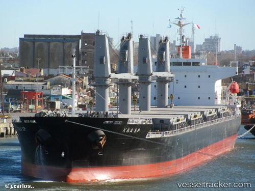
 KERASIA S
Current Status
Where is the vessel?
KERASIA S is currently in 177 nm SE of South Padre Island, based on AIS data received about 1h ago.
Latest AIS update:
Current position: 24.74500° N, 94.25500° W (177 nm SE of South Padre Island)
Average speed (last 7 days): Loading…
Average speed (last 30 days): Loading…
Vessel profile: KERASIA S is a General Cargo Ship with dimensions 177m x 28m.
This page combines live AIS, route history, probable destination signals, nearby traffic, and port activity for practical vessel monitoring.
The current position of vessel KERASIA S is 24.74500 lat / -94.25500 lng. Updated: 2026-03-31 06:04:13 UTCNearest reference points:
- 124 nm SW of Gulfmex Lightering Area
Currently sailing under the flag of Liberia ![]()
KERASIA S built in 2011 year
Deadweight:
33170 tDetails:
Live Vessel KERASIA S Analytics (details, animations, etc.)
Recent AIS points (UTC):
2026-03-31 00:01:10 UTC · 24.69833, -94.07667 · SOG 1 kn · COG -1°2026-03-31 02:19:12 UTC · 24.71500, -94.14667 · SOG 1 kn · COG -1°
2026-03-31 04:10:12 UTC · 24.73333, -94.20167 · SOG 1 kn · COG -1°
2026-03-31 06:04:13 UTC · 24.74500, -94.25500 · SOG 1 kn · COG -1°