 vesseltracker.com
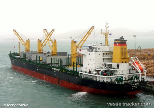
 DIAS WELL
Current Status
Where is the vessel?
DIAS WELL is currently in 15 nm E of Maputo, based on AIS data received less than 1h ago.
Latest AIS update:
Current position: 25.95500° S, 32.84167° E (15 nm E of Maputo)
Average speed (last 7 days): Loading…
Average speed (last 30 days): Loading…
Vessel profile: DIAS WELL is a Bulk Carrier with dimensions 28m x 177m.
This page combines live AIS, route history, probable destination signals, nearby traffic, and port activity for practical vessel monitoring.
The current position of vessel DIAS WELL is -25.95500 lat / 32.84167 lng. Updated: 2026-04-18 06:03:41 UTCCurrently sailing under the flag of Panama ![]()
DIAS WELL built in 2011 year
Deadweight:
31728 tDetails:
Live Vessel DIAS WELL Analytics (details, animations, etc.)
Recent AIS points (UTC):
2026-04-17 23:12:11 UTC · -25.96032, 32.83949 · SOG 0 kn · COG 26°2026-04-18 00:48:15 UTC · -25.96060, 32.83936 · SOG 0.2 kn · COG 22°
2026-04-18 03:39:18 UTC · -25.96088, 32.84047 · SOG 0.1 kn · COG 357°
2026-04-18 06:03:41 UTC · -25.95500, 32.84167 · SOG 0 kn · COG -1°