 vesseltracker.com
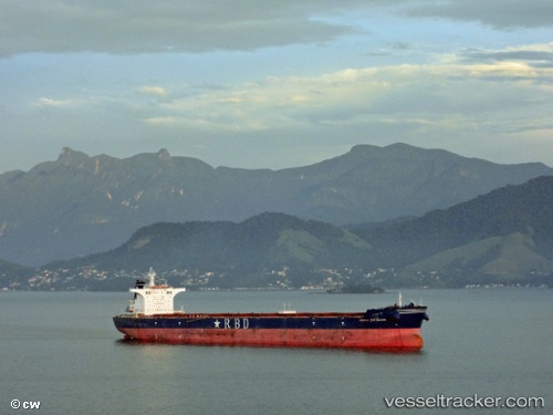
 RIO DULCE
Current Status
Where is the vessel?
RIO DULCE is currently in 45 nm E of Woolgoolga, based on AIS data received less than 1h ago.
Latest AIS update:
Current position: 30.02371° S, 154.05521° E (45 nm E of Woolgoolga)
Average speed (last 7 days): Loading…
Average speed (last 30 days): Loading…
Vessel profile: RIO DULCE is a Bulk Carrier with dimensions m x m.
This page combines live AIS, route history, probable destination signals, nearby traffic, and port activity for practical vessel monitoring.
The current position of vessel RIO DULCE is -30.02371 lat / 154.05521 lng. Updated: 2026-04-18 10:11:37 UTCNearest reference points:
- Near Gold Coast
- Near Labrador
- Near Biggera Waters
Currently sailing under the flag of Marshall Islands ![]()
Details:
Live Vessel RIO DULCE Analytics (details, animations, etc.)
Recent AIS points (UTC):
2026-04-18 04:12:38 UTC · -29.83041, 154.31412 · SOG 1 kn · COG 102°2026-04-18 05:23:29 UTC · -29.83731, 154.33420 · SOG 5.8 kn · COG 236°
2026-04-18 08:20:18 UTC · -29.99341, 154.10353 · SOG 1.8 kn · COG 256°
2026-04-18 10:11:37 UTC · -30.02371, 154.05521 · SOG 1.9 kn · COG 254°