 vesseltracker.com
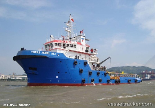
Topaz Jebel Ali
Current StatusWhere is the vessel?
Topaz Jebel Ali is currently in 31 nm NE of AL JUBAIL, based on AIS data received about 2h ago.
Latest AIS update:
Current position: 27.55621° N, 49.98263° E (31 nm NE of AL JUBAIL)
Average speed (last 7 days): Loading…
Average speed (last 30 days): Loading…
Vessel profile: Topaz Jebel Ali is a Offshore Tug Supply Ship with dimensions 13m x 59m.
This page combines live AIS, route history, probable destination signals, nearby traffic, and port activity for practical vessel monitoring.
The current position of vessel Topaz Jebel Ali is 27.55621 lat / 49.98263 lng. Updated: 2026-03-27 10:23:27 UTCNearest reference points:
- 13 nm NE of AL JUBAIL
- Near Al Jubayl
- 44 nm NE of Ras Al Khair
Details:
Live Vessel Topaz Jebel Ali Analytics (details, animations, etc.)
Recent AIS points (UTC):
2026-03-27 04:13:37 UTC · 27.09940, 50.42069 · SOG 5.7 kn · COG 354°2026-03-27 05:55:18 UTC · 27.26589, 50.37325 · SOG 6.8 kn · COG 306°
2026-03-27 08:08:27 UTC · 27.40816, 50.15234 · SOG 6.3 kn · COG 304°
2026-03-27 10:23:27 UTC · 27.55621, 49.98263 · SOG 5.4 kn · COG 340°