 vesseltracker.com
 Manisa Sofia
Current Status
Where is the vessel?
Manisa Sofia is currently in 32 nm W of Paphos, based on AIS data received about 5h ago.
Latest AIS update:
Current position: 34.86156° N, 31.77202° E (32 nm W of Paphos)
Average speed (last 7 days): Loading…
Average speed (last 30 days): Loading…
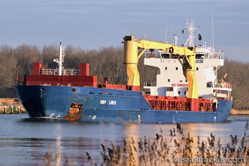
Vessel profile: Manisa Sofia is a Multi Purpose Carrier with dimensions 107m x 18m.
This page combines live AIS, route history, probable destination signals, nearby traffic, and port activity for practical vessel monitoring.
The current position of vessel Manisa Sofia is 34.86156 lat / 31.77202 lng. Updated: 2026-03-25 12:47:00 UTCNearest reference points:
- 11 nm SE of Paphos
- 68 nm SW of Paphos
- Near Limassol
Currently sailing under the flag of Portugal ![]()
Manisa Sofia built in 2011 year
Deadweight:
9273 tDetails:
Live Vessel Manisa Sofia Analytics (details, animations, etc.)
Recent AIS points (UTC):
2026-03-25 09:17:07 UTC · 33.93813, 31.23151 · SOG 12 kn · COG -1°2026-03-25 09:17:07 UTC · 33.93813, 31.23151 · SOG 12 kn · COG -1°
2026-03-25 12:47:00 UTC · 34.86156, 31.77202 · SOG 10.5 kn · COG 30°
2026-03-25 12:47:00 UTC · 34.86156, 31.77202 · SOG 10.5 kn · COG 30°