 vesseltracker.com
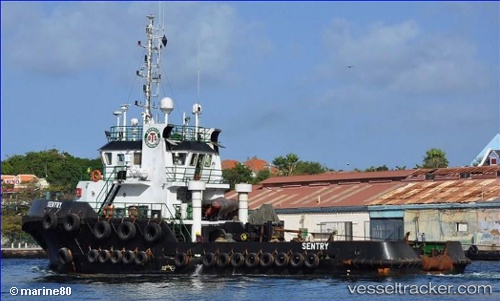
 Sentry
Current Status
Where is the vessel?
Sentry is currently in Near Punta Cana Apt, based on AIS data received about 2h ago.
Latest AIS update:
Current position: 18.72833° N, 68.34667° W (Near Punta Cana Apt)
Average speed (last 7 days): Loading…
Average speed (last 30 days): Loading…
Vessel profile: Sentry is a Tug with dimensions 32m x 9m.
This page combines live AIS, route history, probable destination signals, nearby traffic, and port activity for practical vessel monitoring.
The current position of vessel Sentry is 18.72833 lat / -68.34667 lng. Updated: 2026-03-28 23:56:11 UTCNearest reference points:
- 32 nm N of Punta Cana Apt
- 47 nm N of Punta Cana Apt
- Near CASA DE CAMPO
Currently sailing under the flag of St Vincent Grenadines ![]()
Details:
Live Vessel Sentry Analytics (details, animations, etc.)
Recent AIS points (UTC):
2026-03-28 17:29:08 UTC · 19.12500, -68.82833 · SOG 5 kn · COG -1°2026-03-28 20:08:11 UTC · 18.96500, -68.63500 · SOG 5 kn · COG -1°
2026-03-28 22:05:10 UTC · 18.84500, -68.48833 · SOG 5 kn · COG -1°
2026-03-28 23:56:11 UTC · 18.72833, -68.34667 · SOG 6 kn · COG -1°