 vesseltracker.com
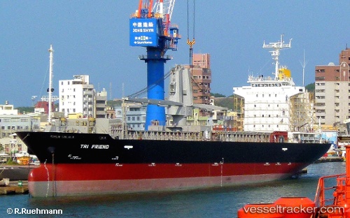
Tri Friend
Current StatusWhere is the vessel?
Tri Friend is currently in 11 nm SW of Pulau Jarak, based on AIS data received about 1h ago.
Latest AIS update:
Current position: 3.89500° N, 99.92167° E (11 nm SW of Pulau Jarak)
Average speed (last 7 days): Loading…
Average speed (last 30 days): Loading…
Vessel profile: Tri Friend is a General Cargo Ship with dimensions 19m x 110m.
This page combines live AIS, route history, probable destination signals, nearby traffic, and port activity for practical vessel monitoring.
The current position of vessel Tri Friend is 3.89500 lat / 99.92167 lng. Updated: 2026-04-18 18:08:06 UTCNearest reference points:
- 11 nm W of Pangkur
- 43 nm NE of Perbaungan
- Near PANGKOR
Details:
Live Vessel Tri Friend Analytics (details, animations, etc.)
Recent AIS points (UTC):
2026-04-18 11:29:01 UTC · 2.99500, 100.82333 · SOG 9 kn · COG -1°2026-04-18 14:04:10 UTC · 3.34373, 100.47900 · SOG 12.3 kn · COG -1°
2026-04-18 15:38:02 UTC · 3.56500, 100.25333 · SOG 12 kn · COG -1°
2026-04-18 18:08:06 UTC · 3.89500, 99.92167 · SOG 9 kn · COG -1°