 vesseltracker.com
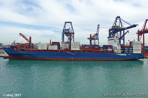
 Ete N
Ete N
Current Status
Where is the vessel?
Ete N is currently in 19 nm SW of Kefalos Ko, based on AIS data received less than 1h ago.
Latest AIS update:
Current position: 36.43991° N, 26.79365° E (19 nm SW of Kefalos Ko)
Average speed (last 7 days): Loading…
Average speed (last 30 days): Loading…
Vessel profile: Ete N is a Container Ship with dimensions 212m x 33m.
This page combines live AIS, route history, probable destination signals, nearby traffic, and port activity for practical vessel monitoring.
The current position of vessel Ete N is 36.43991 lat / 26.79365 lng. Updated: 2026-04-20 23:40:03 UTCNearest reference points:
- 20 nm S of Astypálaia
- Near KALYMNOS
- 11 nm E of GYALI
Currently sailing under the flag of Liberia ![]()
Ete N built in 2012 year
Deadweight:
41139 tDetails:
Live Vessel Ete N Analytics (details, animations, etc.)
Recent AIS points (UTC):
2026-04-20 20:00:27 UTC · 35.85609, 27.51822 · SOG 13.8 kn · COG 314°2026-04-20 21:46:36 UTC · 36.13639, 27.16953 · SOG 13.5 kn · COG 312°
2026-04-20 23:00:49 UTC · 36.33237, 26.92099 · SOG 13.7 kn · COG 320°
2026-04-20 23:40:03 UTC · 36.43991, 26.79365 · SOG 14 kn · COG 316°