 vesseltracker.com
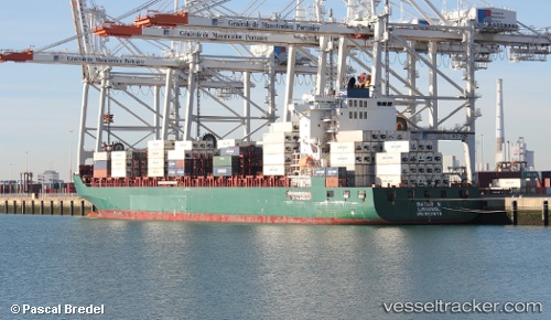
 IRENES SOUTHERN
Current Status
Where is the vessel?
IRENES SOUTHERN is currently in 32 nm E of Nanao Pt, based on AIS data received less than 1h ago.
Latest AIS update:
Current position: 23.58713° N, 118.23372° E (32 nm E of Nanao Pt)
Average speed (last 7 days): Loading…
Average speed (last 30 days): Loading…
Vessel profile: IRENES SOUTHERN is a Container Ship with dimensions m x m.
This page combines live AIS, route history, probable destination signals, nearby traffic, and port activity for practical vessel monitoring.
The current position of vessel IRENES SOUTHERN is 23.58713 lat / 118.23372 lng. Updated: 2026-04-05 16:06:28 UTCNearest reference points:
- 23 nm S of Xiamen Pt
- 18 nm SE of Jiuzhen
- 27 nm S of Xiamen Pt
Currently sailing under the flag of Cyprus ![]()
Details:
Live Vessel IRENES SOUTHERN Analytics (details, animations, etc.)
Recent AIS points (UTC):
2026-04-05 09:50:37 UTC · 24.33053, 119.31438 · SOG 12.7 kn · COG 230°2026-04-05 11:24:16 UTC · 24.16154, 119.01382 · SOG 11.9 kn · COG 233°
2026-04-05 14:23:06 UTC · 23.79352, 118.52257 · SOG 11.6 kn · COG 223°
2026-04-05 16:06:28 UTC · 23.58713, 118.23372 · SOG 11.5 kn · COG 232°