 vesseltracker.com
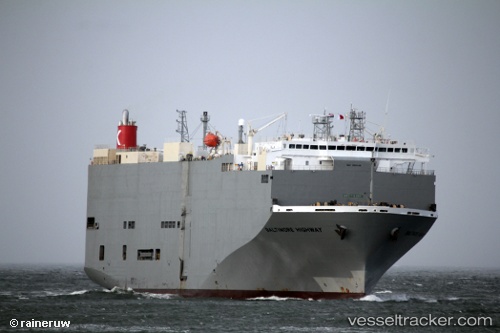
 Baltimore Highway
Current Status
Where is the vessel?
Baltimore Highway is currently in 228 nm SW of Primorsky Krai, based on AIS data received less than 1h ago.
Latest AIS update:
Current position: 42.06584° N, 138.08408° W (228 nm SW of Primorsky Krai)
Average speed (last 7 days): Loading…
Average speed (last 30 days): Loading…
Vessel profile: Baltimore Highway is a Vehicles Carrier with dimensions 180m x 32m.
This page combines live AIS, route history, probable destination signals, nearby traffic, and port activity for practical vessel monitoring.
The current position of vessel Baltimore Highway is 42.06584 lat / -138.08408 lng. Updated: 2026-04-01 12:07:24 UTCCurrently sailing under the flag of Panama ![]()
Baltimore Highway built in 2009 year
Deadweight:
15341 tDetails:
Live Vessel Baltimore Highway Analytics (details, animations, etc.)
Recent AIS points (UTC):
2026-04-01 05:30:27 UTC · 41.37885, -136.30811 · SOG 14.4 kn · COG 295°2026-04-01 08:20:57 UTC · 41.65564, -137.10919 · SOG 14.3 kn · COG 294°
2026-04-01 09:56:55 UTC · 41.82630, -137.53229 · SOG 13.1 kn · COG 300°
2026-04-01 12:07:24 UTC · 42.06584, -138.08408 · SOG 13.1 kn · COG 300°