 vesseltracker.com
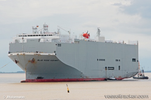
Blue Ridge Highway
Current StatusWhere is the vessel?
Blue Ridge Highway is currently in Near Gonglu, based on AIS data received about 2h ago.
Latest AIS update:
Current position: 31.35505° N, 121.65255° E (Near Gonglu)
Average speed (last 7 days): Loading…
Average speed (last 30 days): Loading…
Vessel profile: Blue Ridge Highway is a Vehicles Carrier with dimensions 31m x 180m.
This page combines live AIS, route history, probable destination signals, nearby traffic, and port activity for practical vessel monitoring.
The current position of vessel Blue Ridge Highway is 31.35505 lat / 121.65255 lng. Updated: 2026-03-28 19:55:10 UTCNearest reference points:
- Near Gonglu
- Near Wu-Sung
- Near Jinqiao
Details:
Live Vessel Blue Ridge Highway Analytics (details, animations, etc.)
Recent AIS points (UTC):
2026-03-28 14:25:19 UTC · 31.11192, 122.55967 · SOG 4.5 kn · COG 269°2026-03-28 16:13:49 UTC · 31.10925, 122.29704 · SOG 12.7 kn · COG 299°
2026-03-28 17:49:09 UTC · 31.24557, 122.00936 · SOG 9.2 kn · COG 281°
2026-03-28 19:55:10 UTC · 31.35505, 121.65255 · SOG 9.8 kn · COG 300°