 vesseltracker.com
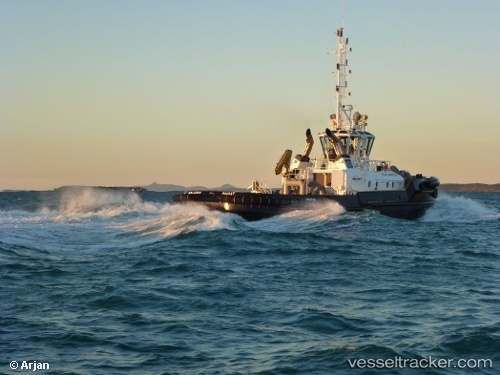
Kalarka
Current StatusWhere is the vessel?
Kalarka is currently in Near DALRYMPLE, based on AIS data received less than 1h ago.
Latest AIS update:
Current position: 21.29130° S, 149.30032° E (Near DALRYMPLE)
Average speed (last 7 days): Loading…
Average speed (last 30 days): Loading…
Vessel profile: Kalarka is a Tug with dimensions 11m x 31m.
This page combines live AIS, route history, probable destination signals, nearby traffic, and port activity for practical vessel monitoring.
The current position of vessel Kalarka is -21.29130 lat / 149.30032 lng. Updated: 2026-04-20 12:03:44 UTCNearest reference points:
- Near Mackay
- Near Whitsunday Island
- Near Abell Point
Details:
Live Vessel Kalarka Analytics (details, animations, etc.)
Recent AIS points (UTC):
2026-04-20 08:04:22 UTC · -21.29128, 149.30031 · SOG 0 kn · COG -1°2026-04-20 10:06:47 UTC · -21.29130, 149.30028 · SOG 0 kn · COG 139°
2026-04-20 10:15:48 UTC · -21.29130, 149.30031 · SOG 0 kn · COG 139°
2026-04-20 12:03:44 UTC · -21.29130, 149.30032 · SOG 0 kn · COG 138°