 vesseltracker.com
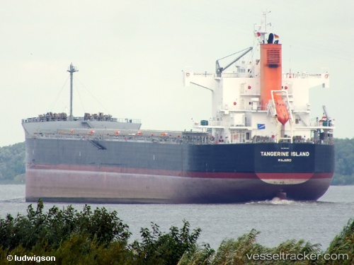
Tangerine Island
Current StatusWhere is the vessel?
Tangerine Island is currently in Near Sulina (Port et Zone Franche), based on AIS data received about 1d ago.
Latest AIS update:
Current position: 45.14004° N, 29.87951° E (Near Sulina (Port et Zone Franche))
Average speed (last 7 days): Loading…
Average speed (last 30 days): Loading…
Vessel profile: Tangerine Island is a Bulk Carrier with dimensions 32m x 229m.
This page combines live AIS, route history, probable destination signals, nearby traffic, and port activity for practical vessel monitoring.
The current position of vessel Tangerine Island is 45.14004 lat / 29.87951 lng. Updated: 2026-04-21 16:48:13 UTCNearest reference points:
- 12 nm SE of Sulina (Port et Zone Franche)
- 13 nm E of Sulina (Port et Zone Franche)
- Near Ust-Dunaisk/Vylkove
Details:
Live Vessel Tangerine Island Analytics (details, animations, etc.)
Recent AIS points (UTC):
2026-04-21 16:48:13 UTC · 45.14004, 29.87951 · SOG 10.4 kn · COG 341°2026-04-21 16:48:13 UTC · 45.14004, 29.87951 · SOG 10.4 kn · COG 341°
2026-04-21 16:48:13 UTC · 45.14004, 29.87951 · SOG 10.4 kn · COG 341°
2026-04-21 16:48:13 UTC · 45.14004, 29.87951 · SOG 10.4 kn · COG 341°