 vesseltracker.com
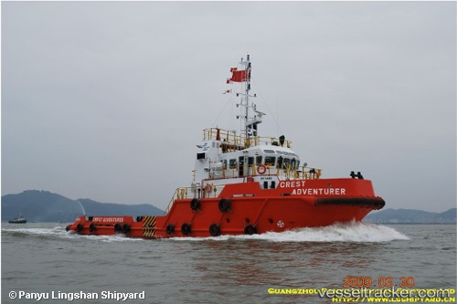
Tan Cang 88
Current StatusWhere is the vessel?
Tan Cang 88 is currently in Near Dong Xuyen Port, based on AIS data received about 1h ago.
Latest AIS update:
Current position: 10.42041° N, 107.14778° E (Near Dong Xuyen Port)
Average speed (last 7 days): Loading…
Average speed (last 30 days): Loading…
Vessel profile: Tan Cang 88 is a Offshore Tug Supply Ship with dimensions 10m x 37m.
This page combines live AIS, route history, probable destination signals, nearby traffic, and port activity for practical vessel monitoring.
The current position of vessel Tan Cang 88 is 10.42041 lat / 107.14778 lng. Updated: 2026-04-17 15:49:24 UTCNearest reference points:
- Near Dong Xuyen Port
- Near Bà Ria
- Near Cai Mep
Details:
Live Vessel Tan Cang 88 Analytics (details, animations, etc.)
Recent AIS points (UTC):
2026-04-17 09:48:00 UTC · 10.42041, 107.14778 · SOG 0 kn · COG 209°2026-04-17 10:10:28 UTC · 10.42038, 107.14777 · SOG 0 kn · COG 209°
2026-04-17 10:10:28 UTC · 10.42038, 107.14777 · SOG 0 kn · COG 209°
2026-04-17 15:49:24 UTC · 10.42041, 107.14778 · SOG 0 kn · COG 210°