 vesseltracker.com
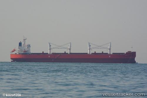
Baltic K
Current StatusWhere is the vessel?
Baltic K is currently in Open sea (no nearby ports in database), based on AIS data received about 1h ago.
Latest AIS update:
Current position: 36.93792° N, 161.44917° E (Open sea (no nearby ports in database))
Average speed (last 7 days): Loading…
Average speed (last 30 days): Loading…
Vessel profile: Baltic K is a Bulk Carrier with dimensions 33m x 190m.
This page combines live AIS, route history, probable destination signals, nearby traffic, and port activity for practical vessel monitoring.
The current position of vessel Baltic K is 36.93792 lat / 161.44917 lng. Updated: 2026-04-01 00:01:12 UTCNearest reference points:
- Open sea (no nearby ports in database)
Details:
Live Vessel Baltic K Analytics (details, animations, etc.)
Recent AIS points (UTC):
2026-03-31 17:19:53 UTC · 36.87343, 159.57166 · SOG 13.2 kn · COG 92°2026-03-31 20:02:33 UTC · 36.89433, 160.31497 · SOG 13.2 kn · COG 88°
2026-03-31 21:34:10 UTC · 36.90345, 160.74181 · SOG 13.6 kn · COG 84°
2026-04-01 00:01:12 UTC · 36.93792, 161.44917 · SOG 13.8 kn · COG 82°