 vesseltracker.com
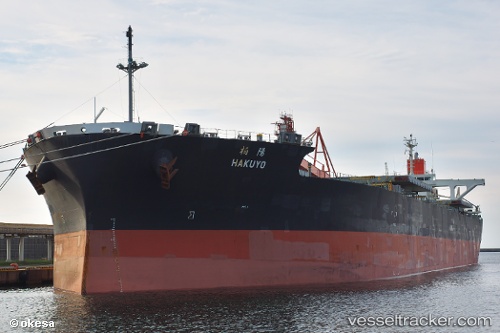
 Hakuyo
Current Status
Where is the vessel?
Hakuyo is currently in 24 nm SE of Zorawina, based on AIS data received less than 1h ago.
Latest AIS update:
Current position: 50.64751° N, 173.34303° E (24 nm SE of Zorawina)
Average speed (last 7 days): Loading…
Average speed (last 30 days): Loading…
Vessel profile: Hakuyo is a Bulk Carrier with dimensions 235m x 43m.
This page combines live AIS, route history, probable destination signals, nearby traffic, and port activity for practical vessel monitoring.
The current position of vessel Hakuyo is 50.64751 lat / 173.34303 lng. Updated: 2026-04-21 19:06:20 UTCNearest reference points:
- 57 nm SW of Zagorow
Currently sailing under the flag of Panama ![]()
Hakuyo built in 2012 year
Deadweight:
92418 tDetails:
Live Vessel Hakuyo Analytics (details, animations, etc.)
Recent AIS points (UTC):
2026-04-21 15:50:18 UTC · 50.78080, 172.52707 · SOG 9.5 kn · COG 95°2026-04-21 16:39:07 UTC · 50.74999, 172.72598 · SOG 9.5 kn · COG 94°
2026-04-21 17:35:09 UTC · 50.71550, 172.96436 · SOG 9.6 kn · COG 94°
2026-04-21 19:06:20 UTC · 50.64751, 173.34303 · SOG 9.9 kn · COG 96°