 vesseltracker.com
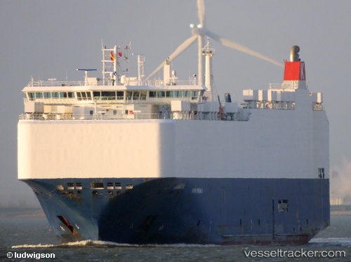
 VIKING EMERALD
Current Status
Where is the vessel?
VIKING EMERALD is currently in 51 nm N of Colomadu, based on AIS data received about 1h ago.
Latest AIS update:
Current position: 8.33966° N, 111.01264° E (51 nm N of Colomadu)
Average speed (last 7 days): Loading…
Average speed (last 30 days): Loading…
Vessel profile: VIKING EMERALD is a Vehicles Carrier with dimensions 28m x 167m.
This page combines live AIS, route history, probable destination signals, nearby traffic, and port activity for practical vessel monitoring.
The current position of vessel VIKING EMERALD is 8.33966 lat / 111.01264 lng. Updated: 2026-04-19 12:07:17 UTCNearest reference points:
- 156 nm SE of Phan Rang-Tháp Chàm
- 142 nm N of Pulau Lang Lang
- 41 nm NW of Brebes
Currently sailing under the flag of Marshall Islands ![]()
VIKING EMERALD built in 2012 year
Deadweight:
12459 tDetails:
Live Vessel VIKING EMERALD Analytics (details, animations, etc.)
Recent AIS points (UTC):
2026-04-19 07:53:57 UTC · 9.25333, 111.48000 · SOG 14 kn · COG -1°2026-04-19 10:02:57 UTC · 8.78167, 111.24667 · SOG 14 kn · COG -1°
2026-04-19 10:18:36 UTC · 8.72613, 111.21703 · SOG 14.5 kn · COG 208°
2026-04-19 12:07:17 UTC · 8.33966, 111.01264 · SOG 14.1 kn · COG 205°