 vesseltracker.com
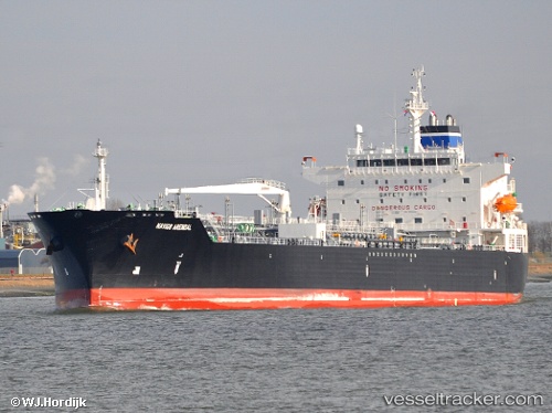
 Arendal
Current Status
Where is the vessel?
Arendal is currently in Near Belén de Escobar, based on AIS data received about 1h ago.
Latest AIS update:
Current position: 34.23887° S, 58.76042° W (Near Belén de Escobar)
Average speed (last 7 days): Loading…
Average speed (last 30 days): Loading…
Vessel profile: Arendal is a Chemical Oil Products Tanker with dimensions 183m x 182m.
This page combines live AIS, route history, probable destination signals, nearby traffic, and port activity for practical vessel monitoring.
The current position of vessel Arendal is -34.23887 lat / -58.76042 lng. Updated: 2026-04-08 11:53:09 UTCNearest reference points:
- Near Avellaneda
- Near Dock Sur
- 10 nm NW of San Pedro
Currently sailing under the flag of Panama ![]()
Arendal built in 2010 year
Deadweight:
50543 tDetails:
Live Vessel Arendal Analytics (details, animations, etc.)
Recent AIS points (UTC):
2026-04-08 05:52:53 UTC · -34.05457, -59.03787 · SOG 0 kn · COG 350°2026-04-08 07:22:26 UTC · -34.05458, -59.03782 · SOG 0 kn · COG 350°
2026-04-08 09:50:41 UTC · -34.07010, -59.02785 · SOG 10.3 kn · COG 144°
2026-04-08 11:53:09 UTC · -34.23887, -58.76042 · SOG 8.2 kn · COG 104°