 vesseltracker.com
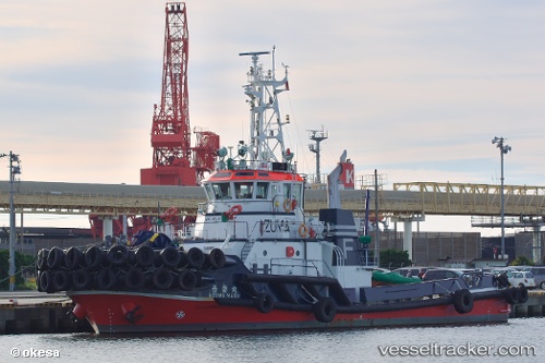
Azuma Maru
Current StatusWhere is the vessel?
Azuma Maru is currently in Near Awaji, based on AIS data received less than 1h ago.
Latest AIS update:
Current position: 34.43073° N, 134.91074° E (Near Awaji)
Average speed (last 7 days): Loading…
Average speed (last 30 days): Loading…
Vessel profile: Azuma Maru is a Tug with dimensions 12m x 34m.
This page combines live AIS, route history, probable destination signals, nearby traffic, and port activity for practical vessel monitoring.
The current position of vessel Azuma Maru is 34.43073 lat / 134.91074 lng. Updated: 2026-04-07 06:09:16 UTCNearest reference points:
- Near Awaji
- Near AKASHI
- Near KADA
Details:
Live Vessel Azuma Maru Analytics (details, animations, etc.)
Recent AIS points (UTC):
2026-04-07 00:03:03 UTC · 34.43065, 134.91064 · SOG 0 kn · COG 215°2026-04-07 02:03:31 UTC · 34.43090, 134.91055 · SOG 0.1 kn · COG 215°
2026-04-07 03:54:10 UTC · 34.43093, 134.91051 · SOG 0 kn · COG 214°
2026-04-07 06:09:16 UTC · 34.43073, 134.91074 · SOG 0 kn · COG 215°