 vesseltracker.com
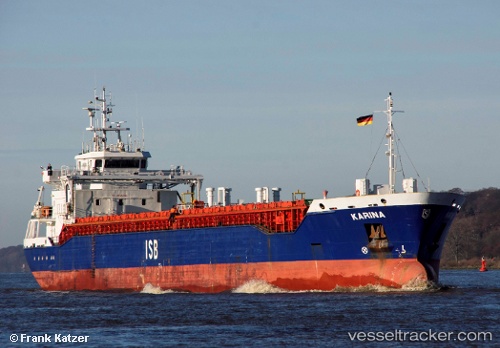
 Karina
Current Status
Where is the vessel?
Karina is currently in Near Grena, based on AIS data received about 2h ago.
Latest AIS update:
Current position: 56.54301° N, 11.09177° E (Near Grena)
Average speed (last 7 days): Loading…
Average speed (last 30 days): Loading…
Vessel profile: Karina is a Multi Purpose Carrier with dimensions 103m x 15m.
This page combines live AIS, route history, probable destination signals, nearby traffic, and port activity for practical vessel monitoring.
The current position of vessel Karina is 56.54301 lat / 11.09177 lng. Updated: 2026-04-08 19:13:45 UTCNearest reference points:
- Near Grena
- Near Glesborg
- 19 nm E of Sæby
Currently sailing under the flag of Antigua Barbuda ![]()
Karina built in 2012 year
Deadweight:
5443 tDetails:
Live Vessel Karina Analytics (details, animations, etc.)
Recent AIS points (UTC):
2026-04-08 13:59:43 UTC · 56.46117, 10.06148 · SOG 0 kn · COG 241°2026-04-08 16:13:03 UTC · 56.58084, 10.27288 · SOG 8.4 kn · COG 58°
2026-04-08 17:41:05 UTC · 56.66888, 10.66135 · SOG 11.5 kn · COG 90°
2026-04-08 19:13:45 UTC · 56.54301, 11.09177 · SOG 10.9 kn · COG 137°