 vesseltracker.com
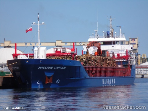
Vessel Hagland Captain IMO: 9521356, MMSI: 259017000 Multi Purpose Carrier
UTC, 58.34540, 11.89810, course: 169, speed: 0
UTC, 58.34539, 11.89813, course: 170, speed: 0
2026-02-18 10:02:20 UTC, 58.34578, 11.89799, course: 169, speed: 0
Live AIS position:
UTC. Near Uddevalla),
updated 2026-02-18 10:02:20 UTC.
Find the position of the vessel Hagland Captain on the map. The latter are known coordinates and path.
marine traffic ship tracker show on live map
The current position of vessel Hagland Captain is 58.34578 lat / 11.89799 lng. Updated: 2026-02-18 10:02:20 UTCCurrently sailing under the flag of Norway
Hagland Captain built in 2012 year
Deadweight:
4450 tDetails:
Last coordinates of the vessel:
UTC, 58.34538, 11.89812, course: 169, speed: 0UTC, 58.34540, 11.89810, course: 169, speed: 0
UTC, 58.34539, 11.89813, course: 170, speed: 0
2026-02-18 10:02:20 UTC, 58.34578, 11.89799, course: 169, speed: 0