 vesseltracker.com
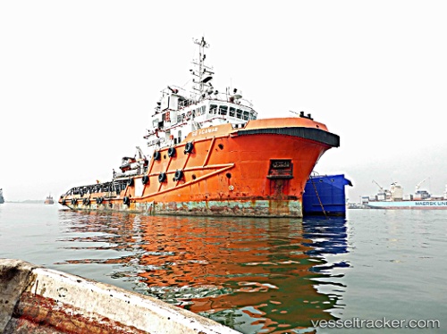
Go Acamar
Current StatusWhere is the vessel?
Go Acamar is currently in 43 nm S of Mackenzie, based on AIS data received less than 1h ago.
Latest AIS update:
Current position: 5.32318° N, 58.04669° W (43 nm S of Mackenzie)
Average speed (last 7 days): Loading…
Average speed (last 30 days): Loading…
Vessel profile: Go Acamar is a Offshore Tug Supply Ship with dimensions 14m x 57m.
This page combines live AIS, route history, probable destination signals, nearby traffic, and port activity for practical vessel monitoring.
The current position of vessel Go Acamar is 5.32318 lat / -58.04669 lng. Updated: 2026-04-20 14:08:13 UTCNearest reference points:
- 38 nm NW of Jarikaba
Details:
Live Vessel Go Acamar Analytics (details, animations, etc.)
Recent AIS points (UTC):
2026-04-20 10:17:43 UTC · 5.58382, -57.90546 · SOG 7.6 kn · COG 234°2026-04-20 11:31:03 UTC · 5.48885, -57.95299 · SOG 7.5 kn · COG 216°
2026-04-20 13:19:57 UTC · 5.36300, -58.00295 · SOG 4.8 kn · COG 216°
2026-04-20 14:08:13 UTC · 5.32318, -58.04669 · SOG 7.2 kn · COG 219°