 vesseltracker.com
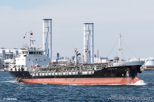
 NOJIGIKU
Current Status
Where is the vessel?
NOJIGIKU is currently in Near AKASHI, based on AIS data received about 1h ago.
Latest AIS update:
Current position: 34.60701° N, 135.04584° E (Near AKASHI)
Average speed (last 7 days): Loading…
Average speed (last 30 days): Loading…
Vessel profile: NOJIGIKU is a Chemical/Oil Products Tanker with dimensions m x m.
This page combines live AIS, route history, probable destination signals, nearby traffic, and port activity for practical vessel monitoring.
The current position of vessel NOJIGIKU is 34.60701 lat / 135.04584 lng. Updated: 2026-04-13 03:56:00 UTCNearest reference points:
- Near AKASHI
- Near Hyogo
- Near Awaji
Currently sailing under the flag of Japan ![]()
NOJIGIKU built in 2009 year
Deadweight:
1203 tDetails:
Live Vessel NOJIGIKU Analytics (details, animations, etc.)
Recent AIS points (UTC):
2026-04-12 21:55:09 UTC · 33.61995, 135.30482 · SOG 12.1 kn · COG 319°2026-04-12 23:41:30 UTC · 33.88268, 135.03194 · SOG 10.8 kn · COG 356°
2026-04-13 02:33:50 UTC · 34.39211, 135.02551 · SOG 10.9 kn · COG 14°
2026-04-13 03:56:00 UTC · 34.60701, 135.04584 · SOG 8.4 kn · COG 305°