 vesseltracker.com
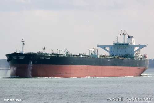
 ST. NIKOLAS
Current Status
Where is the vessel?
ST. NIKOLAS is currently in Near Fateh Terminal, based on AIS data received about 1h ago.
Latest AIS update:
Current position: 25.55034° N, 54.63375° E (Near Fateh Terminal)
Average speed (last 7 days): Loading…
Average speed (last 30 days): Loading…
Vessel profile: ST. NIKOLAS is a Crude Oil Tanker with dimensions m x m.
This page combines live AIS, route history, probable destination signals, nearby traffic, and port activity for practical vessel monitoring.
The current position of vessel ST. NIKOLAS is 25.55034 lat / 54.63375 lng. Updated: 2026-04-17 13:47:42 UTCNearest reference points:
- 11 nm SW of Fateh Terminal
- 17 nm NW of Free Port
- 16 nm NW of Jebel Ali
Currently sailing under the flag of Marshall Islands ![]()
Details:
Live Vessel ST. NIKOLAS Analytics (details, animations, etc.)
Recent AIS points (UTC):
2026-04-17 07:46:22 UTC · 25.54937, 54.63302 · SOG 0.1 kn · COG 304°2026-04-17 10:25:33 UTC · 25.54892, 54.63249 · SOG 0.1 kn · COG 327°
2026-04-17 11:23:32 UTC · 25.54939, 54.63312 · SOG 0 kn · COG 310°
2026-04-17 13:47:42 UTC · 25.55034, 54.63375 · SOG 0 kn · COG 283°