 vesseltracker.com
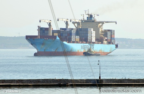
Maersk Cape Town
Current StatusWhere is the vessel?
Maersk Cape Town is currently in Near Port Raysut, based on AIS data received about 1h ago.
Latest AIS update:
Current position: 16.94384° N, 54.00343° E (Near Port Raysut)
Average speed (last 7 days): Loading…
Average speed (last 30 days): Loading…
Vessel profile: Maersk Cape Town is a Container Ship with dimensions 37m x 249m.
This page combines live AIS, route history, probable destination signals, nearby traffic, and port activity for practical vessel monitoring.
The current position of vessel Maersk Cape Town is 16.94384 lat / 54.00343 lng. Updated: 2026-04-07 12:11:01 UTCNearest reference points:
- 103 nm S of Port Raysut
- 106 nm S of Port Raysut
- 110 nm NE of Gross Koris
Details:
Live Vessel Maersk Cape Town Analytics (details, animations, etc.)
Recent AIS points (UTC):
2026-04-07 05:32:28 UTC · 16.94383, 54.00369 · SOG 0 kn · COG -1°2026-04-07 08:16:57 UTC · 16.94382, 54.00320 · SOG 0 kn · COG -1°
2026-04-07 09:44:40 UTC · 16.94383, 54.00325 · SOG 0 kn · COG -1°
2026-04-07 12:11:01 UTC · 16.94384, 54.00343 · SOG 0 kn · COG 66°